The Fraser River floodplain shapes much of the subsurface across Port Coquitlam, depositing layers of silts, organics, and sands that vary sharply over short distances. Mapping these transitions prior to excavation or foundation design requires a method that goes deeper than standard test pits without the cost of an extensive borehole program. Vertical Electrical Sounding (VES) fills that gap efficiently. By injecting a known current through four electrodes and measuring the resulting potential difference, the technique resolves apparent resistivity as a function of depth. In the Citadel Heights area, for instance, readings often indicate low-resistivity clay lenses within coarse fluvial deposits — data that directly influences drainage and settlement predictions. Our laboratory pairs field surveys with grain size analysis to calibrate resistivity profiles against actual soil texture, ensuring the interpreted stratigraphy matches the ground conditions encountered during construction.
Vertical Electrical Sounding reveals hidden clay lenses and perched water in Port Coquitlam soils, preventing surprises during excavation and foundation construction.
Service characteristics in Port Coquitlam
Local geotechnical conditions in Port Coquitlam
A common error on Port Coquitlam sites is relying solely on sparse test pits in areas influenced by buried paleochannels of the Pitt or Coquitlam Rivers. Excavators hit saturated organic silts at 4 meters, where a resistivity sounding would have shown a sharp drop in ohm-m values indicating a compressible lens extending laterally. The result is an emergency dewatering and over-excavation order that delays the footing pour by weeks. Without a prior CPT test or resistivity profile, the contractor has no early warning of the soft zone. Even worse, shallow groundwater flowing through coarse lenses can create preferential pathways that corrode buried utilities over time. An electrical resistivity survey integrated into the site investigation stage maps these anomalies before they become change orders, allowing the geotechnical engineer to design appropriate retaining walls or drainage measures tailored to the actual stratigraphy.
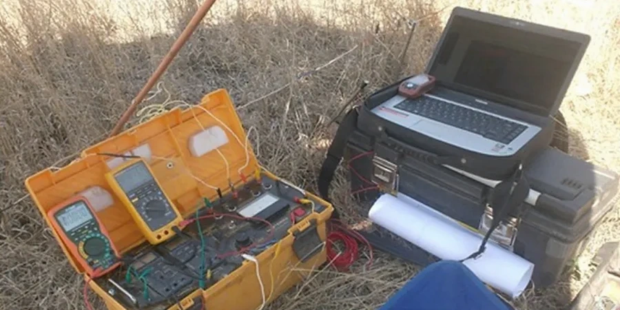
Our services
Our Port Coquitlam resistivity services cover every stage from feasibility to construction QC. Each survey is designed around the specific geologic units mapped on the BC Geological Survey Quadrangle for the area.
2D electrical resistivity tomography (ERT)
Multi-electrode profiles with 5-meter spacing for imaging lateral variations across the Mary Hill bypass corridor and Coquitlam River terraces.
Soil corrosivity assessment
Wenner four-pin measurements at multiple depths to evaluate corrosion risk for buried ductile iron and steel infrastructure, following ASTM G57.
Groundwater exploration VES
Deep Schlumberger soundings to identify aquifer geometry and depth-to-bedrock for irrigation or dewatering well design in the Fraser Valley aquifer system.
Quick answers
How much does a VES survey cost for a typical residential lot in Port Coquitlam?
For a standard residential or small commercial lot in Port Coquitlam, a VES survey with three to five sounding stations typically ranges from CA$890 to CA$1,460. The final figure depends on electrode spread length, terrain accessibility, and the number of vertical profiles required. We provide a firm quote after reviewing the site plan and project objectives.
What depth of investigation can VES achieve in the Fraser Valley deposits?
With a maximum current electrode spacing of 400 meters, we routinely reach depths of 80 to 120 meters in the unconsolidated sediments of the Fraser Valley. The actual depth of investigation is a function of the subsurface resistivity contrast; conductive clay layers attenuate the signal more than resistive sand and gravel units, so we adjust the array geometry accordingly.
Can resistivity surveys distinguish between till and glaciomarine silt in Port Coquitlam?
Yes. The dense Sumas till typically exhibits higher resistivity values due to its compacted, coarse-grained matrix, while glaciomarine silts saturated with brackish pore water produce distinctly lower resistivity signatures. We calibrate the resistivity cross-sections with local borehole logs and laboratory testing to refine the lithologic interpretation.
How long does it take to receive the final resistivity report?
Field acquisition for a standard VES profile in Port Coquitlam is completed in one day. Data processing, 1D inversion, and report drafting require an additional four to six business days. The final deliverable includes resistivity-depth curves, an interpreted geoelectric section, and a concise engineering summary suitable for inclusion in the geotechnical design report.