A common mistake on Port Coquitlam builds is assuming that an open cut in dense glacial till will behave the same as one five blocks south, where the Pitt River has laid down soft, compressible silts for millennia. That assumption leads to sloughing faces, buried utilities, and costly stop-work orders. Geotechnical excavation monitoring eliminates the guesswork. The team tracks lateral movement at the shoring face, pore pressure build-up behind the wall, and settlement at the property line while the excavation is still active. On the Mary Hill Bypass corridor, where cuts often exceed 5 metres, the data feeds direct to the site supervisor so that bracing adjustments happen before a problem becomes a failure. When trenching near the Coquitlam River, where the water table sits barely 1.5 metres below grade, monitoring frequency increases to hourly intervals during dewatering, which is something a static design report simply cannot account for. For deeper urban projects, integrating monitoring data with a deep excavations geotechnical model provides the full picture of soil-structure interaction during construction.
Real-time deflection data from a Port Coquitlam excavation allowed the contractor to advance the dig by an additional 1.2 metres without installing a third strut level, saving two days on the critical path.
Service characteristics in Port Coquitlam
Local geotechnical conditions in Port Coquitlam
Compare a site on the upper slopes of Citadel Heights with one near the old mill along Kingsway Avenue, and the risk profile flips entirely. The Heights sit on glacial till: stiff, overconsolidated, and capable of standing near-vertical for weeks without distress. Kingsway, by contrast, lies on the Pitt River floodplain, where a metre of fill covers 8 to 12 metres of soft compressible silt that loses strength under vibration. An excavation here without monitoring is a liability that insurance adjusters dread. The primary hazard is not catastrophic collapse but insidious settlement that cracks foundations 15 metres from the cut. Monitoring picks up the early trend—usually a 2 mm displacement over 48 hours—and gives the contractor time to adjust the dewatering rate or tighten the struts before the damage becomes a claim. A secondary concern in Port Coquitlam is the seasonal high water table; from November to March, pore pressure readings can spike 30% above summer baselines, and the monitoring plan must account for that hydrostatic shift if the dig extends into winter.
Our services
The monitoring programs deployed in Port Coquitlam cover the full lifecycle of the excavation, from initial dewatering to backfill completion. Each service is configured to the specific soil profile and proximity constraints of the site.
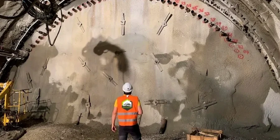
Shoring Deflection Monitoring
Continuous inclinometer profiles behind soldier pile and lagging walls, with automated alerts when cumulative deflection exceeds 0.1% of the wall height or when the rate of movement accelerates unexpectedly.
Settlement & Vibration Monitoring
Optical survey arrays on adjacent buildings, combined with triaxial geophones to measure peak particle velocity during rock breaking or compacting operations within 50 metres of occupied structures.
Pore Pressure & Dewatering Surveillance
Multi-level vibrating-wire piezometers tied to a telemetry system that tracks groundwater drawdown during pumping, ensuring that the effective stress increase does not trigger consolidation settlement beyond predicted limits.
Quick answers
What does geotechnical excavation monitoring cost for a typical Port Coquitlam residential lot excavation?
For a standard single-family lot excavation with inclinometer casing, two piezometers, and bi-weekly manual readings over a 4-week period, the fee generally falls between CA$1,100 and CA$3,770. The range depends on site access, depth of cut, and whether automated data logging is required.
How often are readings taken during an active excavation in soft soils?
On Port Coquitlam sites where the excavation penetrates the compressible floodplain silts, inclinometer and piezometer readings are taken at 12-hour intervals as a baseline. During dewatering start-up or after heavy rainfall events, frequency increases to hourly until the data stabilizes.
Does the city require a monitoring plan for a simple foundation dig under 3 metres?
The BC Building Code triggers mandatory monitoring at 3 metres depth or when the excavation is within a 1:1 influence zone of an adjacent building. Even for shallower digs on the Port Coquitlam floodplain, the geotechnical engineer of record may require settlement monitoring if the soil investigation reveals organic silt layers.
What instrumentation is most critical when excavating adjacent to a heritage structure?
The priority instrumentation set includes automated optical prisms on the heritage facade, crack meters spanning existing fractures, and a real-time inclinometer behind the shoring. The system is configured to send SMS alerts to the site superintendent if movement exceeds 2 mm in any 24-hour window.